|
||
|
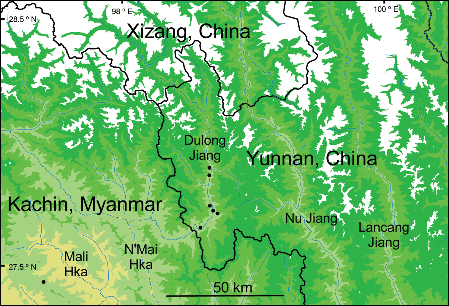
Distribution showing the known locations of Perrottetia taronensis in China and Myanmar. The map uses Shuttle Radar Topography Mission (SRTM) 90 m raster elevation data from Jarvis A, Reuter HI, Nelson E, and Guevara E, 2008, Hole-filled seamless SRTM data V4, International Centre for Tropical Agriculture (CIAT) available from https://srtm.csi,cgiar.org (Reuter et al. 2007). The elevation intervals for the region shown in this map have been set to 0–999 m, 1000–1999 m, 2000–2999 m, 3000–3999 m, and 4000 m and above. All seven collections are from within the 1000–1999 elevation interval shown on the map. Within China to the east and separated by the Gaoligong Shan range is the Nu Jiang (Salween River) and farther still to the east is the Lancang Jiang (Mekong River). |