|
||
|
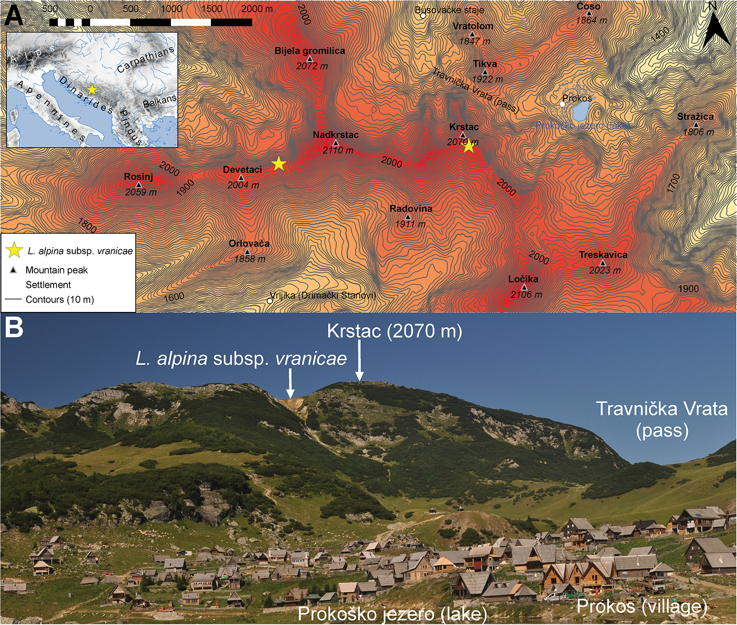
A Map showing two locations of Leucanthemopsis alpina subsp. vranicae found in 2018. The map encompasses the central ridge of the Vranica Mts with main peaks and distinguishable topographic features. The contours are spaced at 10 m with every 100 m bolder. The elevation data comes from the ALOS DEM dataset (Tadono et al. 2014). Map is projected in ETRS89 (EPSG: 3035). B View from Lake Prokoško towards eastern slopes of Krstac (2070 m). From this point, Nadkrstac (2210 m) the highest peak of the Vranica Mts is behind Krstac. Arrow points to the richest population of L. alpina subsp. vranicae found during the excursion in 2018 on the edge of the bluff close to the Krstac peak. Solitary plants were also found along the path from Krstac to Devetaci. It is likely that it also grows on the inaccessible northern slopes of those mountains. |