|
||
|
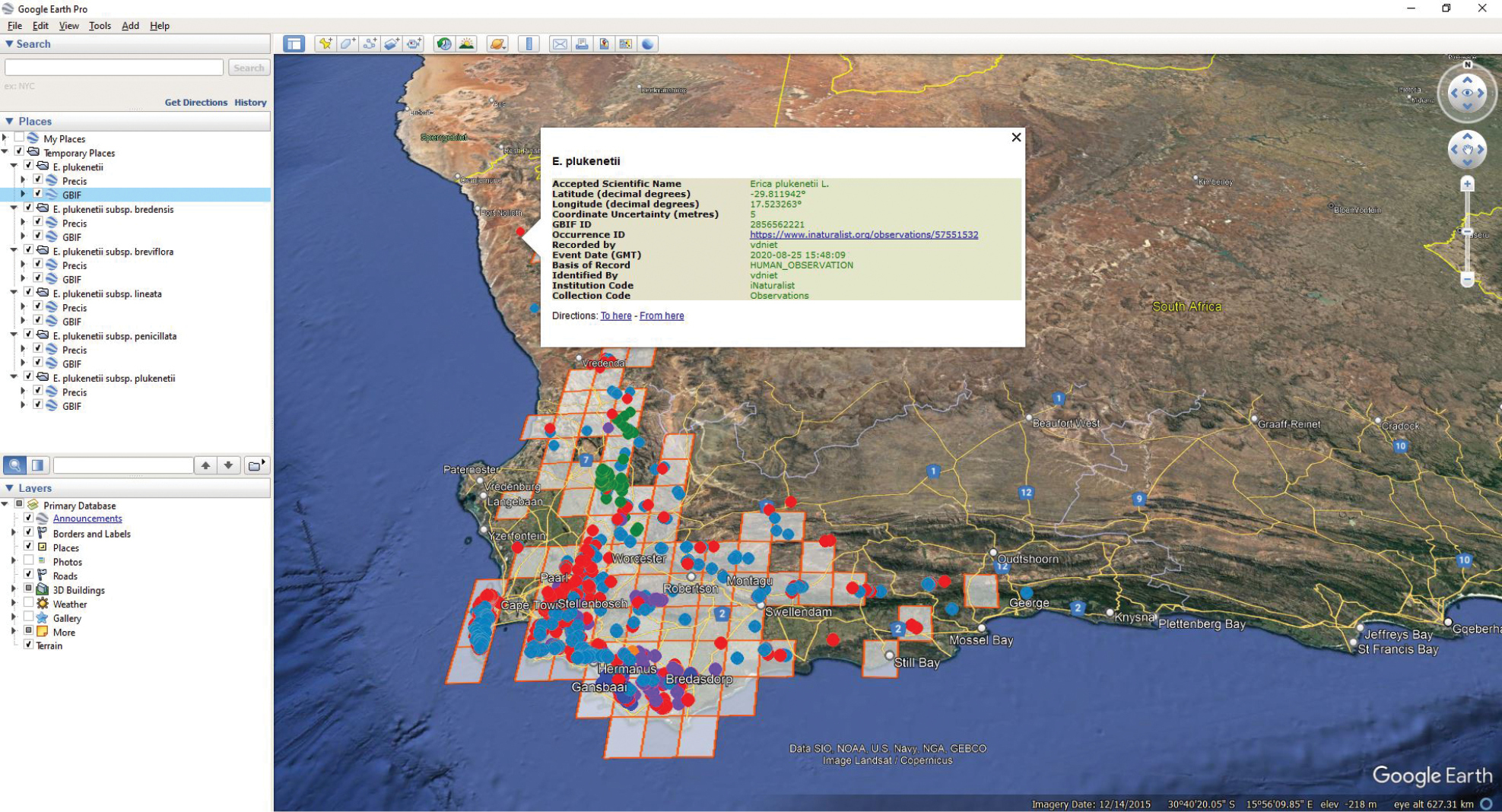
Distribution data presented on a Google Earth map. The Quarter Degree Square (QDS) map references listed in the main aid are projected as grid squares with separate individual dots for openly available GBIF data in different colours for different taxa displayed. In this example, on clicking ‘map distributions’ whilst viewing the inclusive species Erica plukenetii, data points representing observations/specimens determined to species only are presented in red, with those determined to the five different subspecies presented in orange (ssp. bredensis), green (ssp. breviflora), dark blue (ssp. lineata), purple (ssp. penicillata), and light blue (ssp. plukenetii) respectively. On clicking on an individual dot, the underlying information is shown, including links where available, such as in this case an iNaturalist observation. Note that the QDS grid data derived from version 3.00 does not cover all the point data, and that there also isn’t point data representing all the QDS. This could indicate errors and/or gaps in the data that are worth further investigation. |