|
||
|
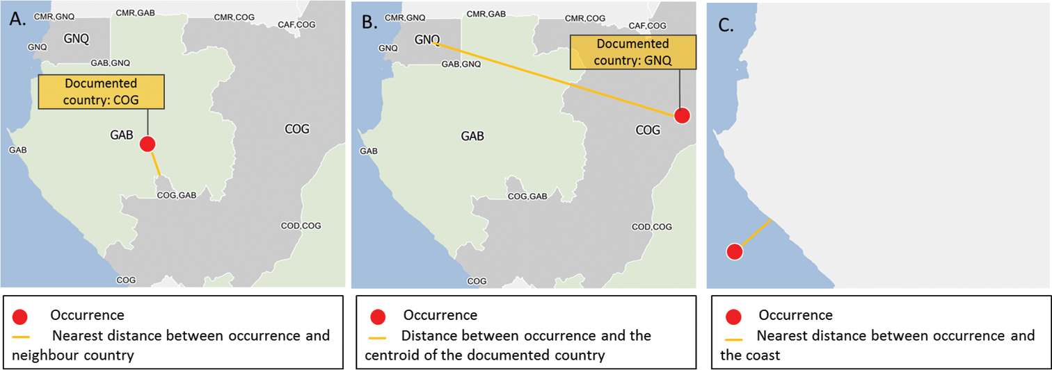
Examples of the georeferencing verification process. a The georeferenced record falls within a neighbouring country (here Gabon - GAB) of its documented country (here Republic of the Congo - COG). The nearest distance between the occurrence and the border of the documented country is computed b The georeferenced record falls within a non-neighbouring country (here Equatorial Guinea - GNQ) of its documented country (here Republic of the Congo). This record is classified as ‘Error’ and is discarded c The georeferenced record lies beyond the coastline. The nearest distance between the occurrence and the coastline of the documented country is computed. |