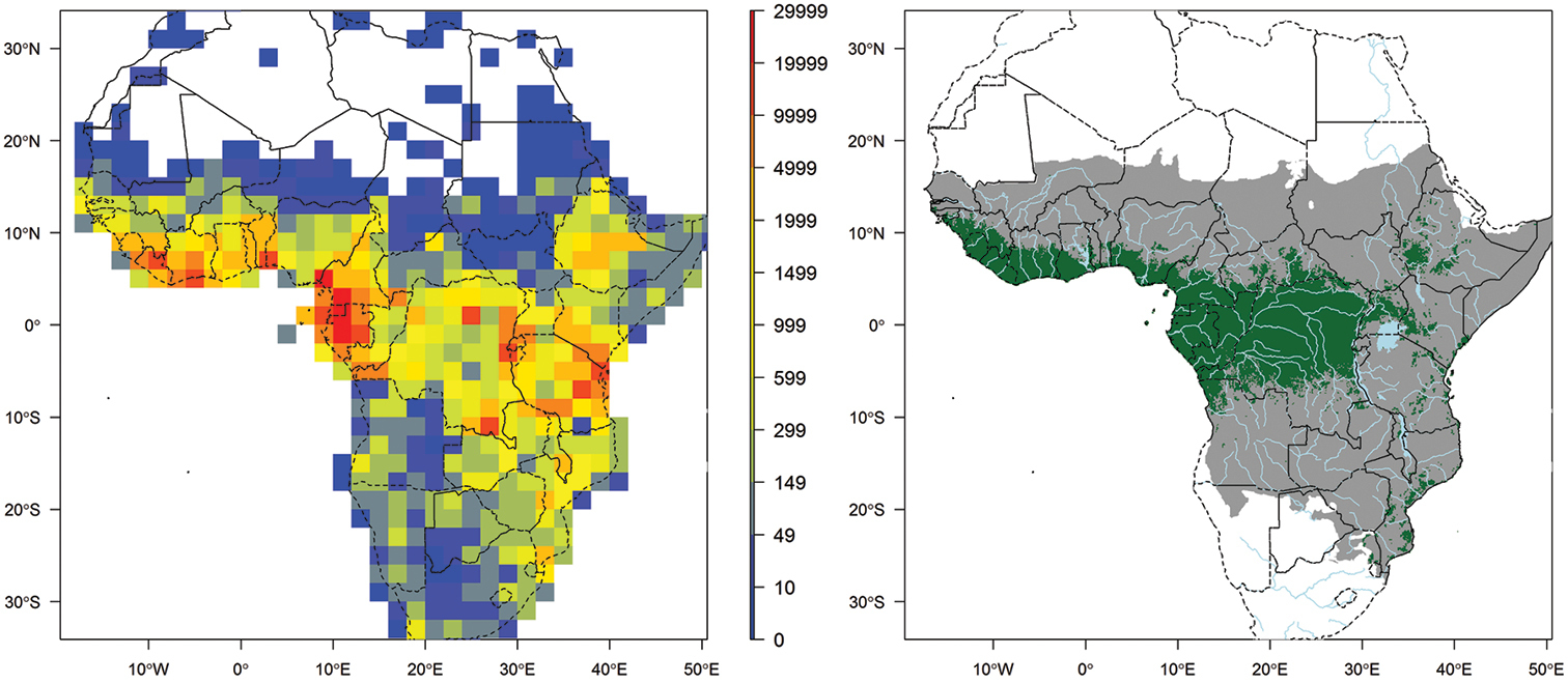
Left map: record density in 2° × 2°cell including all georeferenced records that passed the quality checks. This map includes records that are identified or not to species level. Right map: main extent of RAINBIO geographical coverage from south of Sahel and north of Southern Africa (grey area); extent of tropical rain forest regions adapted from the land cover map published by Mayaux et al. (2004) (green area).


  Part of: Dauby G, Zaiss R, Blach-Overgaard A, Catarino L, Damen T, Deblauwe V, Dessein S, Dransfield J, Droissart V, Duarte MC, Engledow H, Fadeur G, Figueira R, Gereau RE, Hardy OJ, Harris DJ, de Heij J, Janssens S, Klomberg Y, Ley AC, Mackinder BA, Meerts P, van de Poel JL, Sonké B, Sosef MSM, Stévart T, Stoffelen P, Svenning J-C, Sepulchre P, van der Burgt X, Wieringa JJ, Couvreur TLP (2016) RAINBIO: a mega-database of tropical African vascular plants distributions. PhytoKeys 74: 1-18. https://doi.org/10.3897/phytokeys.74.9723